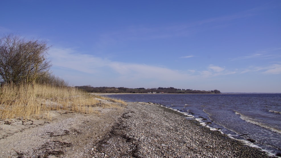
Hiking: Trail at the Paradise at Gedsted
To the west of Gedsted, you will find 'The Paradiet,' as named by the locals, as it is the most beautiful natural gem.
Tracks in the Landscape" are beaten paths that provide access to areas across the country that would otherwise not be accessible to the public. A brochure about the track can be found in the brochure box at the start of the track or can be downloaded at www.spor.dk. Below, you can read more about what you can see on this route. Have a good trip.
The track at Paradiset is located about 30 km south of Løgstør. The marked routes are 2.5 km (yellow route) and 7 km (blue route) and can both be extended with unmarked routes. Have a good trip.
The tracks start from the rest area at Fjordvejen just outside Gedsted. There is a route in the hills at Paradiset and a route to the fjord at the mouth of Lerkenfeldt Å. There is a bridge over the stream with the possibility of extending the walk. The yellow route may be closed during hunting season (see signs).
Old road system
The road along the cliffs of the Stone Age coast, along with hollow roads (6), was part of the old road system that led towards Viborg and the army road / ox road with a connection to the south.
The Meadow
The meadow down towards Louns Bredning is a raised Stone Age seabed. About 7000 years ago, the area was covered by seawater. The meadow rose above sea level about 2000 years ago. The pressure of the ice had partially subsided. The beach meadow right at the coast is occasionally flooded by the fjord and fertile material is deposited between the plants.
Further inland, a strip is seen where the influence of the fjord is not as dramatic. These areas are called beach meadows. The meadow up towards the road is partially grazed by cattle, but where this does not happen, a reed swamp is formed.
The Hollow Road
The path follows an old hollow road up the cliff. Along this road, cattle were driven to graze on the meadow in ancient times. The hay from the meadow was also transported along this road to the farms.
Louns Bredning
Viewpoint overlooking Louns Bredning towards Louns Peninsula (with Alstrup church), Salling, and Lundø. Gl. Ullits church can be seen to the north. The shallow water in Louns Bredning acts as a magnet for many wading and waterfowl. There is a large amount of food here. The tide deposits nutrient-rich sediment, which forms the basis for an impressive food chain, starting with algae; and millions of mud snails, sandworms, and bristle worms end up in fish and birds. Out in the water, scattered large stones are visible, which were brought here by ice glaciers as detached rock fragments from northern Scandinavia.
Paradise Forest
In Paradise Forest and the surrounding scrub, you will find a wildlife different from what you find along the coast and beach meadows. The small forested area is of great importance as a hiding place for hares and deer. Most of our common small birds, which are associated with forests, breed here.
In early spring, primroses and anemones cover the forest floor in Paradise, which is otherwise a mixed forest with beech trees as the dominant feature.
It is unclear why the area is locally called "Paradiset" (Paradise). Before the bypass road cut through the area, it was perceived as a lovely and peaceful place just outside the town, and many excursions have been made here over the years.
Ox Road
The ox road passed by here. The clear traces of centuries-old oxen drives cut through the forest. When a trail became worn and muddy, a new one was made beside it. The road led down to Gedstedbro, which was originally a ford over Lerkenfeldt Å.
Trenches
A little off the beaten path up on the cliff, you can see remnants of trenches from World War II. German soldiers were stationed in Gedsted, and as an exercise in resisting an invasion, the trenches were dug.
Beach Meadow
Tracks continue over the beach meadow to the pedestrian bridge over Lerkenfeldt Å with the possibility of continuing along the fjord. In the winter months, the meadow can be very wet and difficult to pass.